Quick and brief description of the Garmin Edge 530 Altimeter Problem and it Quick Fix:
PROBLEM DESCRIPTION:
1. I had SERIOUS ISSUES with the accuracy of the readings from the built-in Barometric Altimeter for the Elevation gain and the correctness of the data for Grade %.
SOLUTION TO THE PROBLEM, CONCLUSIONS: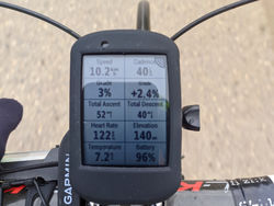

1. The problem with the Elevation gain and Grade % is NOT actually due to the upgrade to version 7.1, but is due to Moisture on the Membrane of the Altimeter!
The Membrane of the Altimeter became WET after washing my bicycle Pips with a hose in the yard while the Garmin was sitting on the handlebar mount.
At that moment, I didn't realize that I had gotten the Barometric Altimeter Membrane Wet. It took me around a week up to 10 days to understand all this and find this annoying problem Fix ... :(
2. The problem with the elevation gain and Grade % AFTER getting the membrane of the barometric altimeter wet is EASILY solved by drying the openings to the altimeter on the back of your Garmin Edge 530 with a hairdryer several times in a row.
3. Buy a protective glass for the Garmin Edge 530 and a silicone protector for the body and back of the Garmin Edge 530. The kit on Aliexpress costs $6-7, but the silicone protector in particular PROTECTS the openings on the back of the altimeter from rain.
4. In heavy rain, I simply cover my entire Garmin Edge 530 with a plastic bag, so I'm sure the membrane of the barometric altimeter stays dry.
Detailed description of the altimeter problem, tests, and solution
Two months ago, I finally got my long-awaited Garmin Edge 530 bike computer.
In December, Decathlon had run out of stock and I had to wait three months until they finally restocked it.
Before getting the Garmin Edge 530, which I named Mandalorian for short (Mando, for even shorter), I used the smaller model of the Garmin bike computer series for a few months: the Garmin Edge 130 - code name Grogu. You can read about why I chose the name Grogu in the detailed two-part review I wrote about it here: Garmin Edge 130 - Grogu. Review from a randonneur.
I deliberately waited a few months to thoroughly test Mando before sitting down to write a new detailed review, this time for the Garmin Edge 530 Mando. Expect the review soon, as this article is solely dedicated to a particularly strange problem and its solution - a problem that appeared out of nowhere after about a month and a half of active use of the super-powerful Garmin Edge 530 Mandalorian bike computer!...
One morning before heading out for my mandatory 10km with 160m elevation gain, I noticed a message on Mando's display:
- Firmware update to version 7.1 is available. Do you want to update? It will take about 2 minutes.
"Yes, why not!" I thought, and pressed the Yes button!... :)
Everything with Mando during these 45 days of daily use was perfect. Maybe they corrected or optimized something important - I thought. It turned out that according to the official announcement of the stable latest firmware version 7.1, they had only corrected some things related to WiFi connectivity - WiFi support in Mando is a function that I never use.
So everything went smoothly with the firmware upgrade to version 7.1. After the upgrade, I used Mando once or twice and didn't notice anything wrong... it was then that I didn't pay much attention to the % Grade indicator or the altitude readings.
So, it's time for the challenging Varna brevet weekend. Specifically, on Saturday there was the Varna 300 km brevet with 3550 meters of elevation gain, and on the next day, Sunday, there was the Varna 200 km brevet with a route to Durankulak.
A detailed itinerary for this exceptionally beautiful but quite challenging Varna 300 brevet will be available soon on my blog here.
For the purposes of this article, I will only publish a brief excerpt from the itinerary, which is currently being written... :)
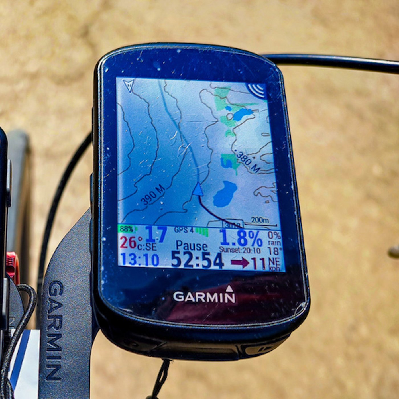
The start of the Varna 300 km brevet was just before sunrise at 6 o'clock in the morning. The temperature in Varna was around zero, but about ten kilometers after the start, near the beautiful Varna lake, the temperature dropped to -3/-5 degrees.
During the day, the temperature reached 18-20 degrees, and in the evening it dropped back to 0 degrees. I mention this because the temperature sensor on the Garmin Edge 530 is necessary for accurate readings of the barometric altimeter (elevation meter) with which the Garmin Edge 530 is equipped, and based on the altitude readings at any given moment, Mando calculates the percentage grade of the terrain at the moment.
I started the brevet in super good condition and for the first 50-60 km I rode together with or slightly behind the fastest colleagues.
During this time, I didn't pay any attention to Mando's readings, I just pedaled and tried not to fall behind the group.
Later on, the ascent towards the plateau before Madara began, and I gradually fell behind. At these moments, I didn't notice any anomalies with the % Grade readings.
After the plateau, we passed through Madara and there was a pretty steep climb towards Madarski Konnik. There, I saw signs along the road showing that there were sections with a 10% gradient, and then 13% gradient.
After the second climb, just before Madarski Konnik, I remember very well looking at the % Grade readings on Mando and they were showing +20%...
Hmmm, I thought to myself: "Wow, this is steep!" Later, during the control in Isperih while I was eating pizza, the slope came up in conversation and I mentioned that my device was showing +20%. Then Itso from Yambol, who I occasionally ride with, said to me: "Hmmm, mine has never shown more than 13%!"
I thought maybe the problem was with his television, but later I realized that the problem was actually with my own device... :) :) :)
The constant ups and downs before and after Isperih made me realize that I often climb with a slope of 3-4%, while Mando's readings indicate a "descent" of -2-3%... 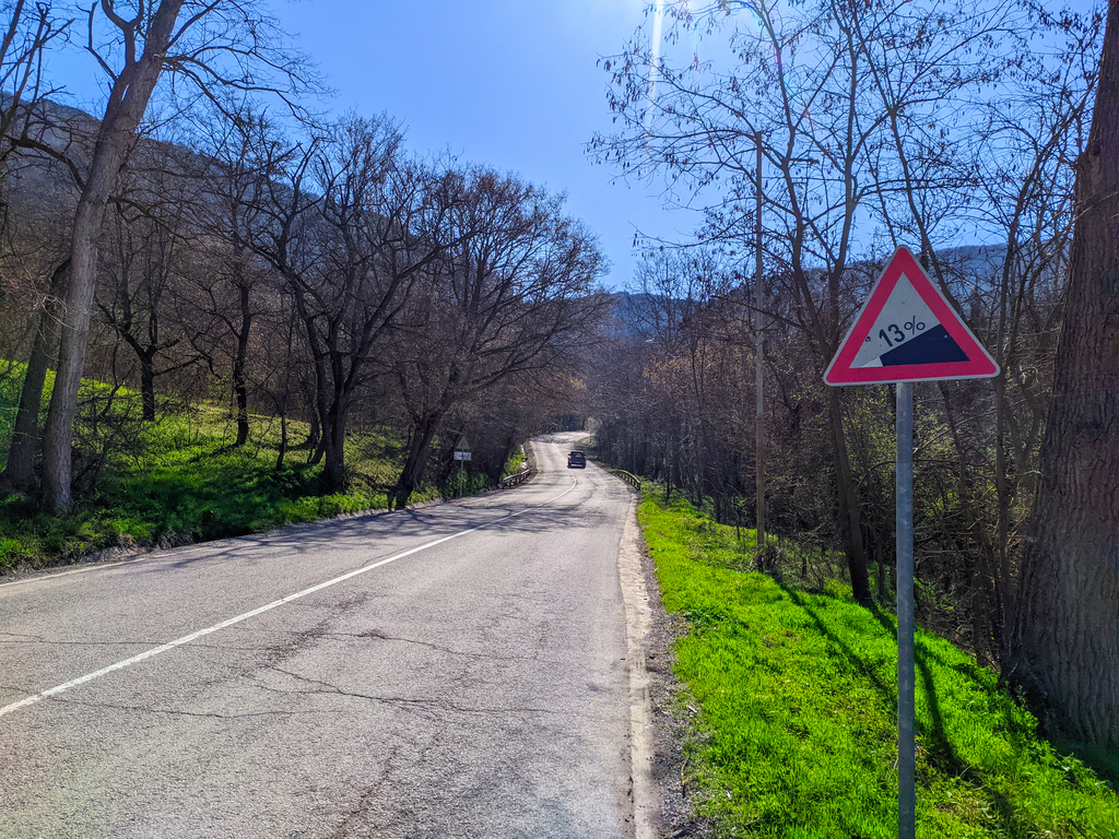
"Enough!" I exclaimed to myself. "What is all this nonsense? Has Mando malfunctioned?"
I figured that there was something wrong with the coverage or GPS readings. Do the Americans mess with GPS readings? Strange... very strange...
At that time, I didn't yet know that the Garmin Edge 530 uses GPS altitude data only once, at initial startup and connection to GPS, to correct for elevation. After that, the elevation data displayed on the Garmin Edge 530 is based solely on its barometric altimeter sensor. But I learned this information much, much later after reading dozens of threads on the Garmin forum and other forums, Garmin guides, and articles on the internet.
The last 100 kilometers of this brevet, we rode in a group of four: Petar Mihaylov and Dancho from Varna, Itso from Yambol, and me. During one climb, Petar and I discussed this anomaly with the % Grade readings.
It turned out that his Garmin Edge 1030 was showing the same anomalies - we were going uphill, but the Garmin was registering that we were going downhill...
We concluded that the problem was something to do with GPS coverage. The next day, he rode the Varna 200 brevet and told me that everything with the incline readings on his Garmin was now okay.
On that brevet, however, my left knee started bothering me at around the 30-kilometer mark, so I decided to take a few days off. As a result, I didn't ride the planned 200-kilometer permanent brevet to Durankulak on Monday and wasn't able to test whether the barometric altimeter had been fixed.
The strangest thing was that after the brevet, Mando's distance reading was absolutely correct at 310 kilometers, BUT the elevation gain was only recorded as 3,000 meters...hmmm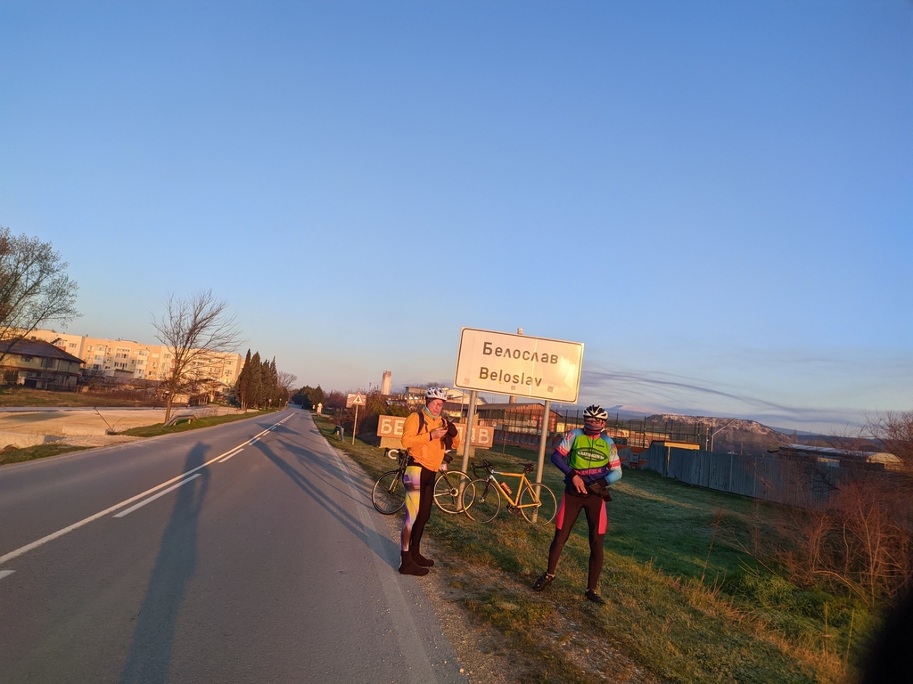
I had Strava recalculate the elevation based on its own maps, and it came out to 3,400 meters...Petko Matarov's Garmin had recorded 3,550 meters of elevation gain for this brevet.
Most of my colleagues' bike computers had recorded around 3,400-3,500 meters of elevation gain.
It was only with mine that there was such a serious anomaly...
Yes, there was definitely some serious problem with my trusted Garmin Edge 530 Mando... ... ... :(
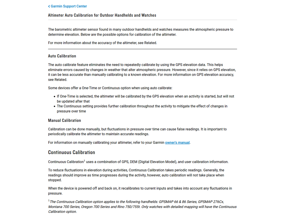
I got back home two days after the Varna 300 and, as always, hosed down my horse Pip's from the sand in the yard after the brevet. Then I went outside with Pip's to test Mando's altimeter.
There's a small hill in front of my house that's about 2 kilometers long with an average slope of 4% and a total elevation gain of 104 meters. I climb this hill almost every morning once or twice after my coffee, especially when the weather is bad. I know very well the exact percentage of slope at every point on the hill.
Something was definitely not right with Mando! On the climb, it showed a slope percentage with a very large delay, sometimes too large. 
But the most absurd thing was that on flat sections after the climb, it displayed readings like +14-15% grade on an extremely flat surface.
The first thing I did when I got home was to search the internet for information on the topic.
I only found information on the same issue in several different threads in the Garmin Edge 530 forum.
In the Garmin 530 forum, I found several separate threads on the same issue, with the first one dating back two years ago:
1. My new Garmin Edge 530 (1 month old) is very slow at changing % gradient
4. Elevation chart and grade display completely wrong on 530 with v 3.50.0.0
Overall, the problem is the same: the Garmin works perfectly and suddenly the elevation and corresponding slope percentage indicators either become extremely slow or the device completely bugs out and gives a negative slope percentage, as if going downhill.
Unfortunately, the only solution to this serious problem, which is given in every one of these threads, is one: returning the Garmin device for a replacement....
Horrible! :( But what if I don't want to part with my faithful Mando? ... :)
Eventually, it turned out that the specific problem had a completely adequate solution, but to reach it I had to go through several firmware downgrades and upgrades of the Mando, dozens of hours of testing, and a lot of digging on the Internet about how the barometric altimeter on the Garmin Edge 530 Mando works... :)
Unfortunately, Garmin is quite stingy with any specific information about this bike computer. The only useful information is quite difficult to find, after reading and sifting through a lot of useless information. 
And so... after reading the four threads on the Garmin forum with the links above, I decided that the problem was obviously hardware-related and that I would have to return the device to Decathlon, where I bought it two months ago.
I packed Mando in his box and called Decathlon's customer service for information about their warranty.
They told me that since the device was purchased online, I needed to print out the invoice from my profile and bring it with the device to the Decathlon store's Information desk.
On Friday, I had the opportunity to go to Decathlon Vitosha in Sofia, so I was there by 7 p.m. The Information desk was staffed by an extremely polite employee who, after listening to my problem with the altimeter on my Garmin Edge 530, called another employee, who arrived within a minute.
This was Dimitar Dimitrov, who also politely listened to the description of the problem and told me a few things, one of which, among other things, didn't make much of an impression on me at the time, but I remembered it and later helped me fix the problem:
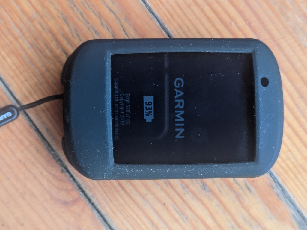
- Garmin Edge 530 is waterproof in principle, but have you ever gotten it wet? Since the barometric altimeter sensor has a very fine membrane that allows for the measurement of altitude.
- These small holes on the back of the bike computer are likely to be the opening to the membrane.
- No, that's not the altimeter opening - I replied, because the previous day I had read a post from an "expert" in one of the forums on Garmin's website who explicitly explained to another person recommending careful cleaning of these openings in the event of altimeter problems. So the "expert" was explaining to him that these two small holes on the back were NOT the altimeter opening, but rather a speaker opening ...
:)
Incorrect and misleading information! The one or both holes on the back of the Garmin Edge 530 are exactly the opening leading to the Garmin altimeter membrane!
Later, in another video on the topic of altitude accuracy on another Garmin model, I saw that if you cover this hole with tape, the readings become completely inaccurate.
Link to the GPLAMA video on Garmin bike computer altimeter issues
https://www.youtube.com/watch?v=bPyEtZH3QaU
IMPORTANT: Dimitar Dimitrov informed me that Decathlon's policy for returning devices with proven defects is to refund your money.
They cannot replace your device ... is that not their policy? ...!?! :(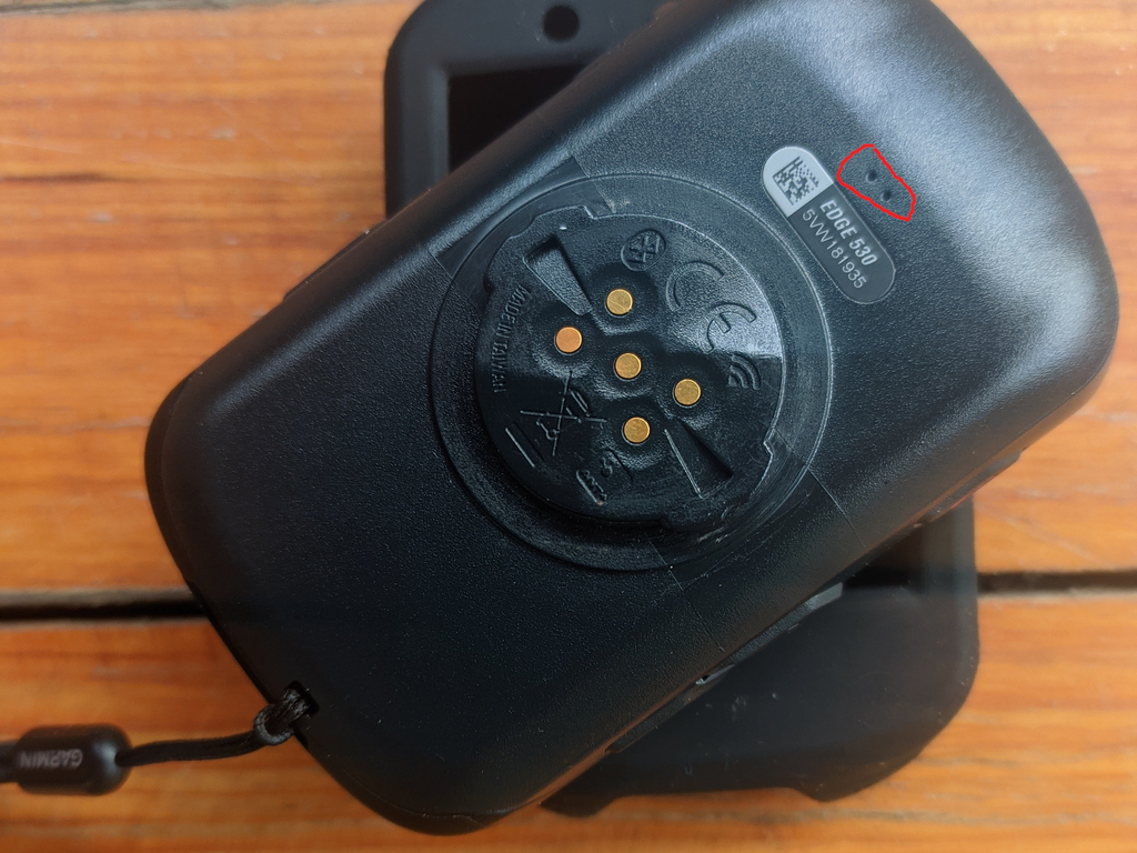
In this case, however, I had bought the Mando two months ago for 450 BGN, and today its price at Decathlon is already 509 BGN ... :)
If I had to return Mando, I would have to pay an additional 50 BGN to get a new Garmin Edge 530!
A very unpleasant piece of news! A quite insane and inflexible policy of Decathlon! :(
Another very valuable and important piece of information that Dimitar Dimitrov mentioned was that his Garmin watch also went crazy at some point after upgrading to the latest firmware version from Garmin ...
So, with Dimitar Dimitrov from the Decathlon service, after this conversation, we agreed that I would leave the bike computer with him, he would test things and downgrade the Mando firmware to an older version to see if that is the problem.
For this firmware downgrade operation, a computer is needed, and I would not have access to a computer in the next few days.
When I received it two months ago, Mando came with the latest stable firmware version at the time, 7.0, and until I upgraded it 45 days later to the new latest stable version, 7.1, I had not noticed any problems!
The next day, I received a phone call from Dimitar Dimitrov from Decathlon, in which he told me that he had searched for information on the problem and that according to my bike computer, it had been updated to a too new version, as when searching on Google for "garmin edge 530 firmware," the top result for the latest software version shows information for version 6.25 Beta:
https://www8.garmin.com/support/download_details.jsp?id=14953
In fact, the problem is due to the confusing and rather difficult to find information on the Garmin website. The information is poorly structured, some old pages are displayed, and there is no way to find the actual information you need if you are looking for the latest stable firmware version... 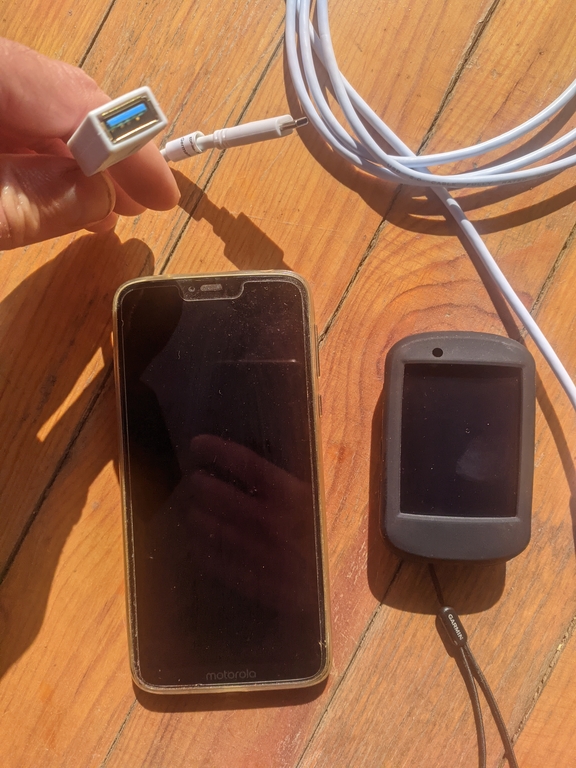
There is information on version 7.1 in the Garmin forum, which I have been using for the last 10 days, but even in the previous days, I searched for where to download version 7.0, with which Mando came, and it turned out that the thread in the Garmin forum for version 7.0 has been deleted! ... :(
... ufffff
So, I spoke on the phone with Dimitar Dimitrov from Decathlon, and he told me that he was very busy that day in their service center and that he would not be able to downgrade it, he could possibly try it at home after work.
I thanked him for his research and call, and we agreed that I would go to the service center in the evening to pick up Mando and see what I could do on my own.
I came across an article on the internet that explained how to downgrade the firmware on a Garmin device.
In fact, the process of downgrading the firmware on a Garmin device is quite easy and well-described on their website.
Manual Upgrade or Downgrade Procedure for Garmin Edge 530 Firmware
1. Download the archive file for the version you need.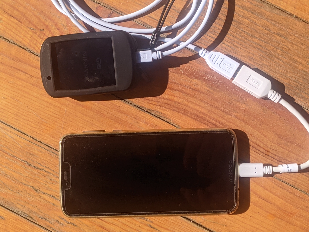
2. Extract the archive file and locate the GUPDATE.GCD file.
3. Connect your Garmin device to your computer.
4. Copy the extracted GUPDATE.GCD file from your computer to the Garmin directory on your device.
5. Disconnect the device from the cable and the device will prompt you to downgrade the firmware.
That's it! :)
I realized that I could actually perform this entire operation on my phone using an OTG cable to connect my Garmin device to my phone.
Of course, I didn't have an OTG adapter with me, so I went to Technopolis and bought one for 15 BGN.
Right there in the Technopolis parking lot, I downgraded the firmware on Mando to stable version 6.20.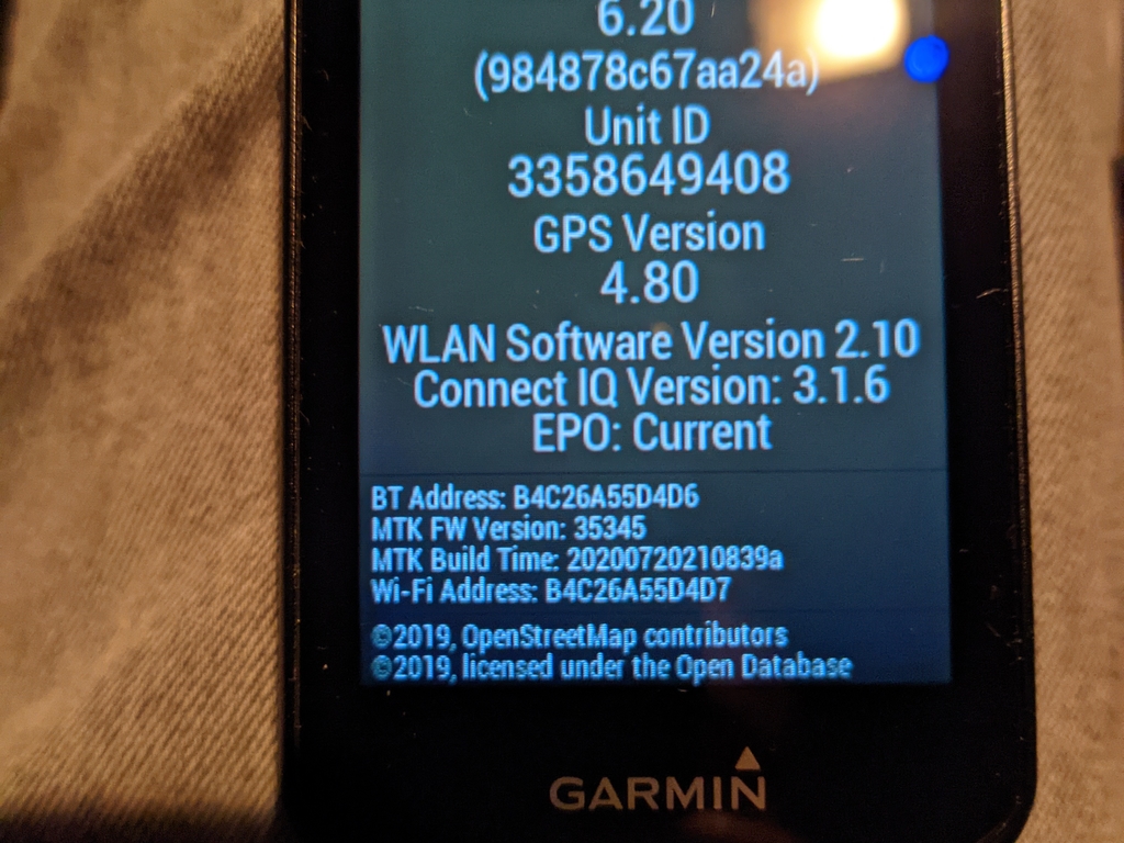
ATTENTION: When downgrading the firmware on a Garmin Edge 530 to an older version, all information on the device will be erased and lost - settings, ride history, GPS tracks, etc.!
Since I didn't have my bike with me, I decided to test what elevation readings the Garmin would show while driving to Vitosha.
This was a good opportunity to load up a few tubes of Jiva water from Yarema!!!
:) :) :)
The results of this first test with firmware version 6.20: the Garmin showed the altitude data correctly BUT with a significant delay!!!
There were no anomalies like before when it gave me negative percentages while climbing or +15 meters while driving on a flat road!
However, the update of the readings was very slow - it took about 40 seconds to show the real percentage of ascent or descent ... and that is much, much slower compared to how the altimeter worked before!
Fact!
Later that evening, after these tests and after returning from Yarema to Mladost, I upgraded again to version 7.1 and did another climb with the car, this time only to Bistritsa - the altimeter readings at some point got messed up again ... uffff :( It started showing me totally wrong numbers for the percentage, even in the case if I ignore the big delay of 40+ seconds.
Ugh, nightmare!
The next morning, I downgraded again to the latest beta version 6.26, since nowhere on the Internet could I find where to download the so necessary version 7.0, with which Mando came!
With Beta version 6.26, Garmin again showed correct elevation reports, BUT again with very slow data update - about 40+ seconds after the descent is over and you drive on a flat road, Garmin starts showing a slope of 0%
Well, that is definitely quite far from the way Mando worked before!
Even at a place with a significant slope in the center of Dragalevtsi, I got out of the car and made a few descents and ascents on foot to see how Garmin would behave outside the car in direct contact with the air and the ambient temperature.
Link to my Strava recording of my test walk on Garmin Edge 530 from the center of Dragalevtsi up and down a hill with a slope of 7-10%:
https://www.strava.com/activities/5146140612
Unfortunately, the same issue persists - correct readings but extremely slow update of the current elevation and slope percentage!
What a hassle!
Definitely, there are still problems. Downgrading the software removed those abnormal measurements on level or inverse slope up or down, as before, but everything is still very, very slow now!
Finally, after all these days, I got back home.
Here, I had a computer, and I could do a more extensive and in-depth search and study of the problem! Hooray!
Manual calibration of the barometric altimeter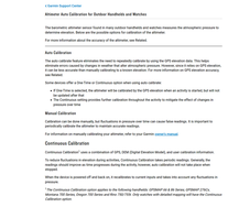
The only way to calibrate the altimeter on Garmin Edge 530 that we have in the menu is to save a certain point and manually set the exact elevation there. When starting a track record from that point, Garmin will take into account this altitude data...
I tried it several times - no effect, unfortunately!
Another important feature to keep in mind is that the altimeter on Garmin Edge 530 updates only ONCE every time after the initial power-up of the cycling computer and GPS connection.
However, you should note that more elevation data based on GPS readings is NOT taken into account. This is a 100% fact with Garmin Edge 530!
You can find detailed information about the possibilities for manual adjustment of the altimeter on Garmin devices with a built-in barometric altimeter in the manual here:
Garmin Support Center: Altimeter Auto Calibration for Outdoor Handhelds and Watches: https://support.garmin.com/en-GB/?faq=FhOYuggxmV6Atph276U4h8
In the morning after returning home, I took my horse Pips and did some altitude tests on Mando's altimeter on the hills around. 
The results of my tests with the bike were absolutely the same as my tests from the previous days with the car and on foot:
Relatively accurate reports on elevation .... but very slow update after changes in elevation and percentage slope % Grade!
I came back home and shook myself again for version 7.0 of the software. Fortunately, the topic in the forum was still available, BUT for some reason, the moderators from Garmin have deleted the post itself and the link to download the file with version 7.0.
Here is the link to the topic, which for some reason has been deleted by one of the admins in the forum: https://forums.garmin.com/sports-fitness/cycling/f/edge-530/246011/new-edge-530-version-7-00-now-available
Page Not Found
I searched Google for archived files with the file name as I assumed it was for version 7.0 - the same file name, but with a different number: NO ... there is no such file ... :)
It turned out later that even the name of the archive with this specific firmware version 7.0 differs from the others ... :)
My last hope at that moment was to search for an archived copy of the page before it was deleted in THE WAYBACK MACHINE ... https://web.archive.org
:) :) :)
And yes! For happiness, there were two archives on the page and the archive file for version 7.0 was sitting on Garmin's servers!!!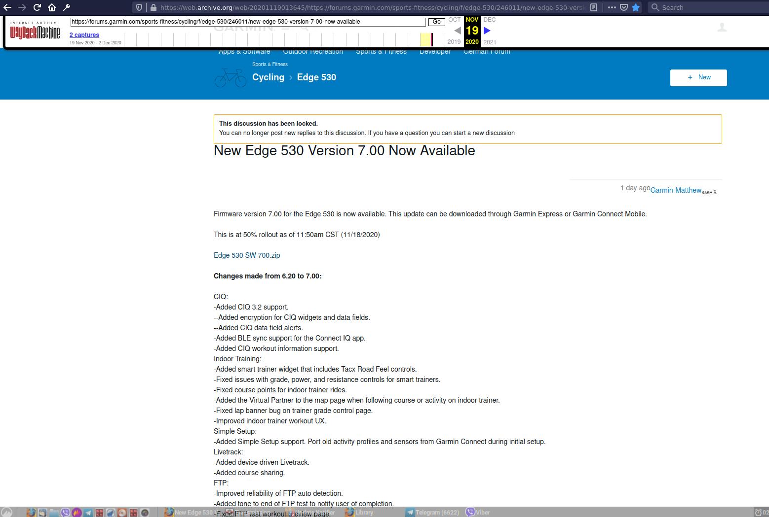
Here's a link to the page archives!
And here's a link to the much sought-after announcement for version 7.0.
Hooray!
I downloaded the file and immediately upgraded my Garmin Edge 530 Mando to the much sought-after version 7.0
Meanwhile, a serious rain had started outside...
But I couldn't wait to test it out!
I dressed up and went out for a test ride with Pips and Mando!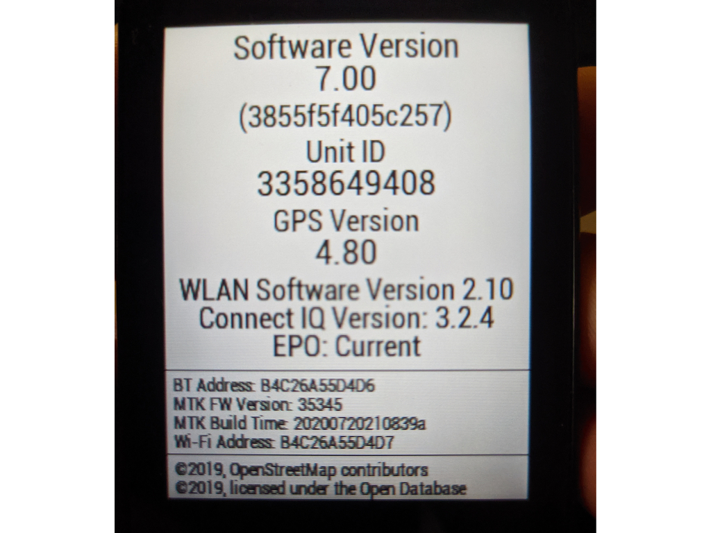
And yes! Everything was working correctly and as it should!
Hooray!
... I was in a hurry with my joy, though, as it turned out there was still something very, very important to learn about the peculiarities of the Garmin Edge 530 altimeter principle of operation!!! :)
During my first test going up and down the hill everything was super trooper! Precise measurement of elevation and gradient percentage, and normal update speed after changing the percentage of ascent and descent - within or around 20 seconds after changing the elevation!
I climbed up and descended, and everything was perfect! It was raining heavily, but I didn't notice it, I only looked at the altitude and % grade indicators...
I said to myself, let me do another test anyway! ... And suddenly, at the beginning of the second climb, Mando froze at 1% grade, while I was climbing at 5-6%...
Enough already!
NOOOOOOOOOO! :(
No! That's not true, just look!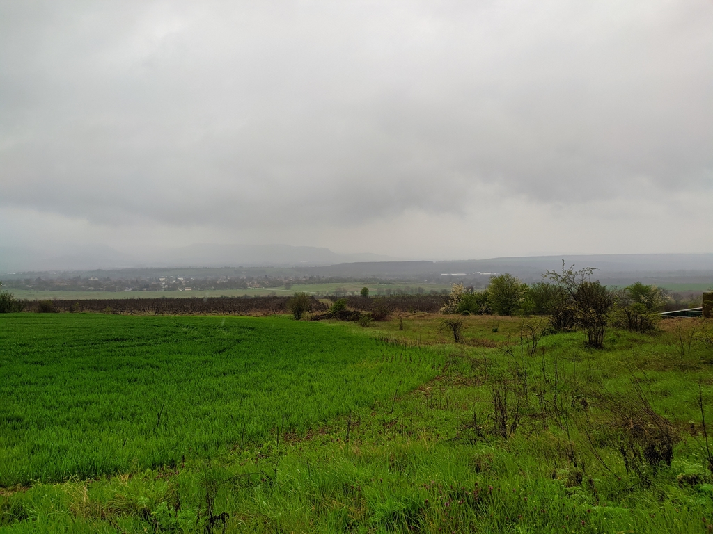
I climbed the hill and descended it while the altimeter updated and corrected the elevation every 5-7 minutes, and occasionally it suddenly started showing percentages around 15-17% grade for a few seconds, then returned to 1%...
Ohhh!
I went home wet and miserable! Just when I was getting excited after a week of reading, testing, and periodic disappointments that everything was finally fixed... here we go again, a problem.
I sit at home by the window, turn on Mando and it shows that I'm at an altitude of 45 meters immediately after turning it on, then as it connects to GPS satellites it updates momentarily to the correct altitude of 130 meters, but then it starts either dropping several meters per minute to 100m...80m...etc. or it suddenly rises from 130m to 180m...210m...
Totally wrong altitude readings!
And it doesn't stop... up and down! :(
I upgraded and downgraded to version 6.26 Beta ... NO effect, same thing...
Upgraded to version 7.1 ... STILL the elevation goes up and down by a few meters per minute...
And then I remembered Dimitar Dimitrov's words from Decathlon about getting wet...
Oh, yeah, Mando was soaking wet from the pouring rain during the tests... ???
But it's supposed to be waterproof, right?
So, I grabbed a hair dryer and dried it on the lowest heat setting. I dried Mando for a few minutes, turning it around from all sides, it got warm - not too much, but it did get warm.
Hope it dries out!
I'm looking at the elevation readings - they're still going up and down... :(
Hmmm, well, I decided to revert back to version 7.0, with which Mando worked correctly after all!
From the Settings / System / Device Reset menu, I selected Delete Data and Reset Settings
IMPORTANT: In case of any issues, always use THIS menu specifically: Delete Data and Reset Settings and not just the first menu: Reset Default Settings!!!
I installed version 7.0 and started configuring the menus I use one by one.
Meanwhile, the altitude data seemed to be changing less frequently...
And at one point, after about half an hour, the barometric altimeter stabilized at 130 m and stopped its dance up and down!
And then I realized what happened!
The altimeter's membrane had gotten wet from the rain and had started registering whatever it wanted.
Drying it with a hairdryer worked, but it still took a little time!
:) :) :)
I searched for information on the internet and yes! Fact!
After rain and membrane wetting, altitude readings go crazy... :) :) :)
Here are links to two topics I found on problems with Garmin altimeters after rain:
https://www.roadbikereview.com/threads/garmin-question.362281/
The next morning - today - I tested Mando thoroughly, uphill and downhill, and then on the flat.
Everything started working like clockwork again! Quickly and correctly!
Hooray! Hooray! Hooray! :)
SOLUTION TO THE PROBLEM, TAKE NOTE:
1. If your Garmin is working fine, don't upgrade unnecessarily!
2. The problem with elevation and % grade may not necessarily be due to upgrading to version 7.1, but rather due to water getting into the altimeter membrane when I washed my bike with a hose in the yard. At that time, my Garmin was on the handlebar mount. I didn't realize that I had wet the membrane of the barometric altimeter - the altimeter.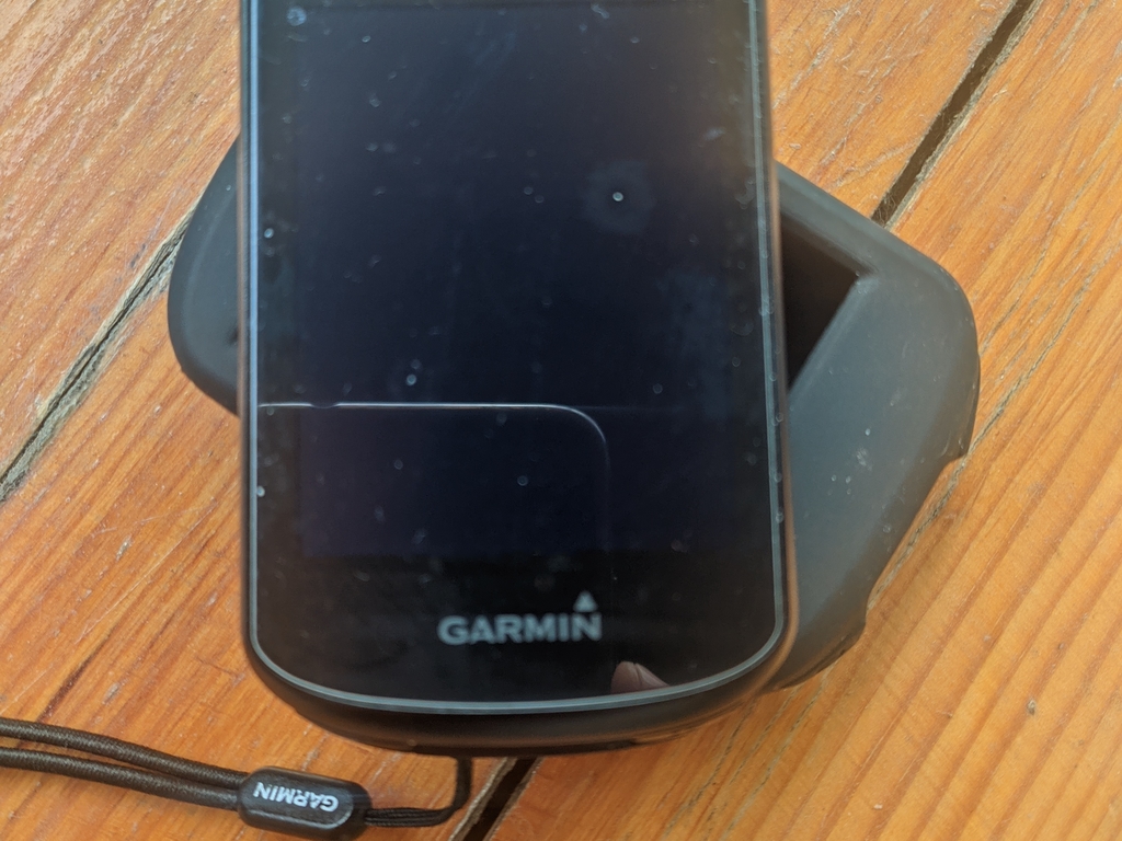
3. The problems may actually be due to upgrading to version 7.1 of the firmware!... But I don't plan to upgrade again now to test that!!!... :) :) :) I'm sticking with the perfectly working version 7.0!
4. The old firmware version 6.20 and beta version 6.26 generally work okay, but with much slower updates from the altimeter data. It takes at least 40+ seconds compared to under 20-second updates with version 7.0
5. Buy a protective glass and a silicone protector for the Garmin Edge 530. On Aliexpress, the set costs 6-7$, but the silicone protector, in particular, provides great protection for the altimeter openings from rain.
RECOMMENDATIONS:
Download the Sensible Grade Data field from Garmin ConnectIQ for quick and accurate measurement of % change in elevation:
Sensible Grade: https://apps.garmin.com/en-US/apps/dab102f5-7172-49e4-9b46-b726a760e2ac
This additional field provides fast and up-to-date information on the percentage of slope in real time!
I recommend it!
I use it together with Garmin's % Grade data (see the Grade chicken in the picture on the right) and will definitely continue to use Sensible Grade.
That's all! :)
Thank you for taking the time to read this long and detailed article describing a problem and the long path to its solution.
Good luck and see you on the road!